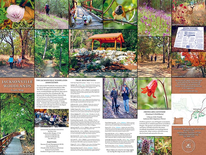
It is hot off the press! The new and updated Jacksonville Woodlands Association’s (JWA) trail map is now available. At this time, the maps can be found at Woodlands trailheads and Jacksonville’s Visitor Center. In addition, the City of Jacksonville has uploaded the map to their Avenza Maps account so that it is georeferenced and may be accessed electronically. For those hikers familiar with Jacksonville’s Forest Park map, it will feel and use much the same.
In fact, the new JWA map format will look like the Forest Park map for several reasons. The 24” X 18” map was built by the same cartography company, Benchmark Maps, a highly-regarded group based in Santa Barbara, California, but with a local office. Their representative, Neil Allen, is a meticulous professional, who is patient and accommodating.
The JWA owes the biggest debt to Clayton Gillette, the volunteer who walked every foot of the trails at least twice, measuring distances, recording location of the many information panels, benches and other features found in the Woodlands. He donated many hours of his time and steps to make this map possible. His attention to detail and time spent on the editing were essential to the map’s accuracy and usefulness.
The photos, trail descriptions and written information on the reverse side of the map were the result of efforts by many amateur photographers and Woodlands history experts. Of course, the major Jacksonville history and Woodlands expert is Larry Smith and we thank him for all his help. The format for the reverse side was easier due to the advice and assistance from Forest Park volunteer and Woodlands’ friend, Tony Hess. Clayton and Tony’s support has been invaluable, and they deserve thanks from our hikers, as well as from the JWA. Because the Jacksonville Woodlands Association is a non-profit organization, this map, as are all projects, possible by the generous support of donors. We are grateful to all who have given in the past and encourage those who wish to continue that support with further donations toward the publication of the new map or any other Woodlands project to please do so.
Finally, as with all projects of this nature, we will find and will be alerted to errors and changes that may need to be addressed in the next edition or printing. We do not expect these to be large or to be a hindrance in the use of the map, however. In the meantime, we encourage local and visiting hikers to enjoy the Woodlands and this new and improved tool.
Please contact us or donate at Jacksonville Woodlands Association, P.O. Box 1210, Jacksonville, OR 97530.
Nice nature walk.Walked it several times and did some geo caching, There is alot of history in this walk .