Trail Talk – July 2025
THAT FEELING we get that something or someone is watching us seems to be a residual reaction from our cell memory of living a much more tenuous existence. But it also gives rise to our inherent ability to take in clues from our environment that allow us to develop a strong sense of place. This awareness of our surroundings, once a vital survival tool, is there, for many just below the surface, as we make our way through the world.
On recent visits to high places, vistas if you will, where our view brings in the hills and mountains surrounding our local valley, curious minds want to know, “What is the name of that distant peak?” Of course, as the adage reminds us, “The people who are here call it (fill in the blank), but what its real name is, only it knows.”
Within a short drive of our homes, coupled with a bit of hiking, we can visit these high places. With maps and compasses, or with a phone app such as PeakFinder, we can identify many of the surrounding peaks. But then that familiar itch of the intrepid traveler kicks in, and we ask ourselves, “What peaks could I see if I stood atop that yonder mountain?”
Maybe it’s time for yet another hike up to Panorama Point in the Woodlands or even higher to Twin Peaks and Bear Ridge in Forest Park. When did you last stand atop Table Rock or Roxy Ann Peak? Have you visited Mt. Ashland, Wagner Butte, or Dutchman Peak in the Siskiyou Mountains recently? Fire lookouts were manned there for a reason.
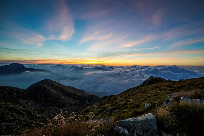
For folks wanting a bit more of an outing, and the subsequent all-encompassing view shed, the hike up Mt. McLoughlin is a must-do. Mid-summer is most popular as the lingering snowbanks melt and the trail opens. For folks with an aversion to clouds of mosquitoes, holding off until late summer is preferable. One can also expect less traffic, though days are shorter, trails are dustier, and storms become more likely.
It’s a strange phenomenon that our perception of distance changes so remarkably when standing atop these high places as opposed to being “down below” looking back up. Things appear so much closer, just there at our feet, so to speak. Our eyes search out familiar roads and buildings when our view is of our valley, and standing atop a truly high mountain, we’re prone to wonder at the identity of those other high peaks in our newfound aerial neighborhood.
But, alas, back to earth. Now our legs carry us down to more mundane places. Perhaps, as we leave Twin Peaks Saddle in Forest Park, we use the improved extension of Atsahu Trail that carries us to Owl Hoot, then Boulder, and onward to the lower parking areas. If we’re biking, we can use this route for a long, winding downhill as a reward for the long ride up. But caution is appreciated to yield to uphill travelers on these steep slopes. Happy trails.
 Trail Talk is a monthly column by Clayton Gillette about hiking the Jacksonville Woodlands trail system. For more information, please visit the Jacksonville Woodlands Association website at