Trail Talk – February 2015
A great way to celebrate Valentine’s Day (or any day) with a loved one is to take a hike on one of the Jacksonville Woodlands or Forest Park trails.
We are pleased to invite you to check-out the two new interpretive panels on the three-quarter mile-long Zigler Trail in the Woodlands system. The panels tell the fascinating history of how the city’s 1870 fire-fighting water supply was enhanced by building a concrete cistern on Jackson Creek, which was later used in 1900 to supply water for locomotives on the Jacksonville Railroad. At the end of Woodlands’ Zigler Trail, head to the Jackson Forks Trail to access the many other Woodlands trails.
In the Forest Park, a very accessible and easy trail for everyone is the Canyon Falls Trail. This nifty trail gets the highest rating from both kids and dogs, both of which are allowed to run off-leash in the Forest Park! (Remember, dogs must be on-leash in the Woodlands trail system) The trail climbs gently for three-quarters of a mile, never more than a few feet from Jackson and Norling Creeks. This stretch of trail has more waterfalls than any other trail and at its upper trail head, four more trail heads start for the more adventurous hikers to explore higher parts of the Forest Park.
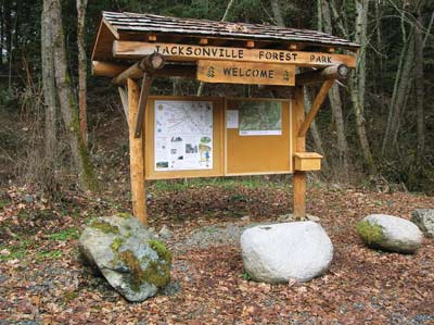
Over the last two years, the Forest Park has been expanded with two new trails—Shade Creek and Leg Burner, bringing the total miles of trails to twenty miles. Five new trails totaling seven miles of additional trail have been flagged and are ready to be built. The first of these trails has just been completed, called the “Atsahu Trail.” At over two miles long, Atashu is the Shasta name for Sugar Pine. It runs from the saddle at the top of Twin Peaks Trail past the Norling Mine to Jackson Ridge, crossing Arrowhead Pass Trail and Shade Creek Trail. All of these new trails and future trails can be found on the new and updated Forest Park Trails Map. The map is available now at the kiosk in the Forest Park, as well as the Visitor Information Center near the Post Office. The easiest way to get the new map is to take a hike in the Forest Park, and stop at the kiosk at the entrance. HAPPY HIKING!
Please note: at the Forest Park Kiosk, hikers will now find the new trail map along with a donation envelope to help raise funds for the Forest Park…all donations are sincerely appreciated and will be used to enhance the Forest Park Trail system!

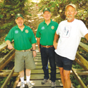
 Trail Talk is a monthly column by Tony Hess, Gary Sprague & Bob Budesa about hiking the Jacksonville Woodlands trail system. For more information, please visit the Jacksonville Woodlands Association website at