Trail Talk – June 2016
Ok. So you’re a first-time visitor to Jacksonville’s Forest Park. Yes, you’ve heard the talk about Jacksonville’s claim to being the “Hiking Capital of Southern Oregon,” and you want to experience the trails in the Jackson Creek Watershed. Where to start?
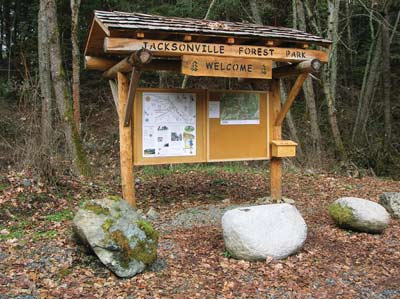
As you drive up Reservoir Road just west of town and arrive in Forest Park, you’ll come to a kiosk and parking area that is signed as “P1.” Be sure to stop here and get a park map and orient yourself to the park’s layout. There are 6 other designated parking areas farther up into the park along with other wide areas to park near trailheads. Most have kiosks with information and maps. Trails emanating from these sites take adventurers up along the 3 stream canyons that make up the watershed. Other trails climb-up and contour along the 4 surrounding ridge lines.
Volunteer park staff, who maintain the trail system in Forest Park, have measured some loops from the parking areas P1, P2, P3, and P5 that allow you to return back at your starting point. These loops are marked with colored diamonds and have “loop cards” to carry and return to the box upon completion of your hike. Let’s mentally hike one of these loops.
The blue, 3-mile loop from P1 is a popular hiking and running loop. As you leave the parking area, you cross Jackson Creek and climb through a madrone thicket up to the grade of the Historic Bullis Railroad. Heading upstream, the gentle grade takes you above Jacksonville’s old town reservoir and past the site of a tragic rail accident. Continuing on through mixed forest, keep an eye out for seasonal wildflowers. Larkspur and iris are quite stunning in late spring. Soon you come to a road crossing and another bridge across Jackson Creek. Here you’ll come to a bench alongside the seasonal stream, a great spot for a rest in the riparian forest of red alders. Decomposed granite from the uplands glitters with fool’s gold.
Leaving the bench, you arrive at a junction, where you turn left and head upstream past a series of waterfalls, climbing s stairwell above “Volkswagen Falls” where an old VW laid rotting for years. Again crossing the creek you arrive on “Boulder Trail” which takes you back down through the park along an old hydraulic mining ditch. The mixed forest hugs the steep hillside, and old stumps give you an idea of some of the large trees that grew here before loggers and miners arrived. The level grade of the historic ditch makes for enjoyable hiking, and soon you drop down to a lower ditch and “Old Miners’ Trail.” Here you hike past a gold mine adit and down through a large historic hydraulic mining site.
From here, your trail winds down to your starting point. Having explored just one of a baker’s dozen of measured, marked loops, you are anxious to come another day and explore more of this spectacular hiking paradise.
 Trail Talk is a monthly column by Clayton Gillette about hiking the Jacksonville Woodlands trail system. For more information, please visit the Jacksonville Woodlands Association website at