Trail Talk – October 2015
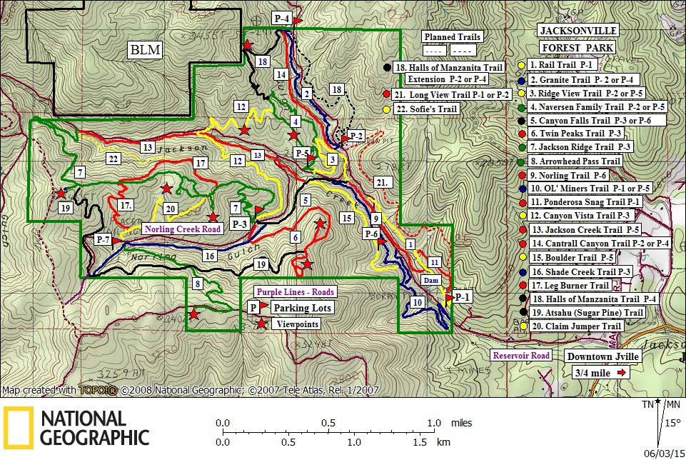
The Forest Park is a big area, 1,100 acres to be exact. With many sloped hillsides, its actual size is even larger with twenty-four miles of trails spread-out over twenty-two trails…park hikers and bikers can really get to some far-out locations.
In the early years of the park’s development, it wasn’t uncommon to have heard hikers wondering, “Where are we?” Today, thanks to a greatly-enhanced Forest Park trails map, hikers and bikers now have color-coded, numbered, and GPS-coded trail accuracy to make their journey better.
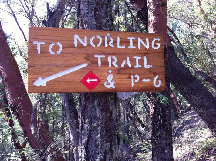
Your Forest Park volunteers also have two improvement projects underway. The first will include the installation of a dozen small kiosks at major trail heads and intersections. These green kiosks will have a laminated “You Are Here” map, with an arrow pointing to the current location on the overall trails map. Secondly, in the corner of the big map will, you’ll find an enlarged drawing listing the trails that intersect at a particular location. The second project is the installation of information signs to guide the hiker or biker to another trail, or to one of the six parking areas. The signs are made from two-inch thick redwood, with information letters and numbers engraved with a router tool, and brightly painted for increased visibility.
Although there are signs at each trail head identifying the name of the trail, (for a total of 44 trail head signs) another 100 plus signs have been installed along all the trails with further location information.
With all the new enhancements in your Forest Park, we hope you get out and enjoy the fall colors and cool weather!
 Trail Talk is a monthly column by Tony Hess, Gary Sprague & Bob Budesa about hiking the Jacksonville Woodlands trail system. For more information, please visit the Jacksonville Woodlands Association website at