Trail Talk – March 2015
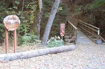
Learning how to get around in the Jacksonville Woodlands and the Forest Park trail systems can be challenging to first-time visitors. Even returning hikers and mountain bikers enjoying these diversified natural areas can get confused in the myriad of trails. After all, there are 15 miles of trails on 300 acres in the Woodlands, and 22 miles of trails on 1,100 acres in the Forest Park—for a total of 37 miles of trails. When the Forest Park adds four miles of new trails already in the planning stage, there will be 41 miles of trails open in these two city parks. Getting around on the trails takes a little planning, and there is a lot of information available either at the trail heads, the kiosks in the parks, in town at the visitor’s center and city offices.
The best help are the trail maps which contain a lot of information. The Jacksonville Woodlands Association produces two maps for the Woodlands trails. The Take-A-Hike trail map is a handy 9” x 16” trail map available for free at most major trail heads, city offices, and the Jacksonville Visitors Center. It’s a good map to fold up and stuff in your pocket or backpack while you explore the trails. On the Woodlands kiosks and at many trail heads, a large 16” x 18” map is displayed with a YOUR ARE HERE ARROW. This beautiful map is done in color, and covers the whole city of Jacksonville to serve as a guide at the many entrances to the trails from town. On the other side of this map is a history of how the Woodlands was developed over the years. It may be obtained at the Jacksonville Visitors Center by the Post Office. The Forest Park has two kiosks, one at the park entrance on Reservoir Road and the second at the large parking lot one-third mile up Reservoir Road. These kiosks always have notices posted concerning new trails, trail regulations, or just interesting facts about wildlife in the park. There are two maps on the kiosks. The big 20” x 30” map is an enlarged print of the standard 12” x 18” map available for free at the kiosks. It too is available at the city offices and the Jacksonville Visitors Center.
And, just added on the kiosks is a variation of the standard map on which the trails are color-coded to indicate whether each trail is “hiker only,” “mountain biker only,” or open to both hikers and bikers. This is a handy map if you want only hiking trails, or as a mountain biker to see your open trails. The Forest park is always changing so be sure to check-out the kiosks for all the latest information.
 Trail Talk is a monthly column by Tony Hess, Gary Sprague & Bob Budesa about hiking the Jacksonville Woodlands trail system. For more information, please visit the Jacksonville Woodlands Association website at