 Come out and enjoy FOREST PARK DAY this Saturday, MAY 7, 2011 – 10:00am to 2:00pm
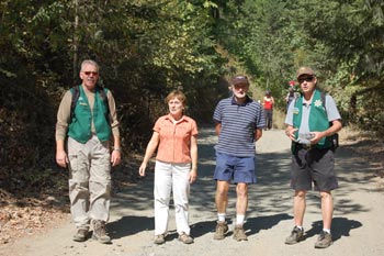
Explore the new trails for hiking, walking and biking. Over 10 miles of clearly marked trails for visitors of all ages.
Trails and Sites:
- Caves
- Beautiful Scenery
- Views
- Brooks & Streams
- Jacksonville Dam & Reservoir
- Maps & Jacksonville Park Rangers will be available for assistance.
Location: From Jacksonville take HWY 238 for 0.7 mile to MaryAnn Drive (right turn). Take an immediate left onto Reservoir Road and follow signs for 1 mile to the Kiosk, where Parking is available. Other parking locations are at the Reservoir, the MRA Parking lot & the Red Rock Quarry.
The Park’s additions are new trails, another bridge, and trail maps. Trail maps are available at the Kiosk at the Park entrance just below the dam, the visitors’ center in Jacksonville, and the city offices. Also a big print version of the maps is mounted on the kiosk ready for everyone to plan their hiking trip into the beautiful 1,080-acre city park.

The Reservoir at Forest Park
With nearly eight miles of trails established in 2010, two new trails totaling 1& 1/4 mile were added since last fall. One of these is the 3/4 mile extension to the existing Granite Trail, which brings the length of this trail to 2 miles. The extension starts at the top end of the Granite Trail, which is easily accessed from the Reservoir Road via a big trail sign that points to the Granite Trail Trailhead. This trail extension is an easy walk along an old, almost-level, logging skid road, gaining only 200 feet in ½ mile. Then it goes through an area of very big, 15-foot tall Manzanita shrubs, and ends up on the Naversen Family Trail ridge. This section has been nicknamed the Halls of Manzanita!
The second new trail is called the Ponderosa Snag Trail after the big pine snag which sits along it. This old snag is three feet in diameter and 80 feet tall. Also on the trail is one of the biggest madrone trees to be found, with a diameter of four feet at the base. This new trail can be found by going to the Rail Trail from the kiosk, and walking 100 feet on the Rail Trail. It travels on the hillside above the reservoir and comes back to the Rail Trail at the site where the train wreck occurred in 1917 on the old Bullis logging railroad.
Check out the new Interpretive Panel featuring the newspaper article from 1917 that describes the brave actions of the engineer Denver Marsh. He tried to save the fireman Charles Schumpf by throwing him off a runaway train loaded with logs, only to be killed himself when the speeding, out of control train smashed into the 75-foot trestle across a ravine. Ten feet of replica railroad track in front of the Interpretive Panel shows how the railroad was built.
At the Golden Water Cave is a new 38-foot bridge over Cantrall Creek. This is the second bridge to be built in the park, and offers a beautiful view of the creek in both directions.